
Smyrna ZIP Directory Coverage
Four ZIP codes matter to Smyrna searches. The 30080 label serves much of the central, northern, and eastern city, including City Hall. The 30082 area covers much of southern and western Smyrna. USPS groups 30080 through 30082 under Smyrna, but the exact special or PO-box status of 30081 was not verified in the official material reviewed. At the Cumberland and Vinings edge, 30339 uses an Atlanta postal label even where Smyrna and Cobb geography remain central to the record question.
| ZIP Code | Areas Covered | Post Office | Notes |
|---|---|---|---|
| 30080 | Central, northern, and eastern Smyrna; City Hall | USPS Smyrna grouping | Some deliveries moved to 30339 in 2014 |
| 30081 | Smyrna postal group | USPS Smyrna grouping | Current special classification needs USPS confirmation |
| 30082 | Southern and western Smyrna | USPS Smyrna grouping | Some deliveries moved to 30339 in 2014 |
| 30339 | Cumberland, Vinings, and the Cobb edge | Atlanta postal label | Postal city does not settle municipal jurisdiction |
This coverage table is a postal orientation, not a parcel-level boundary map. USPS does not claim that a ZIP result proves a person or company occupies an address. In the same way, an Atlanta mailing label in 30339 does not answer whether a parcel falls within Smyrna's city limits. Use the ZIP code directory to pick the next source, then confirm jurisdiction with official city and county mapping.
Confirm Smyrna ZIP Codes
The official USPS lookup has three useful modes. By Address returns the postal result for one complete location. By City and State shows codes associated with Smyrna, Georgia. Cities by ZIP reverses the question and identifies the preferred city label for a code. This matters on the east side, where the postal label may say Atlanta even though a local records task still depends on Cobb or Smyrna boundaries.
| USPS lookup mode | Input | Best use |
|---|---|---|
| By Address | Street, city, state | Confirm one delivery ZIP and ZIP+4 |
| By City and State | City and state | Review postal codes tied to Smyrna |
| Cities by ZIP | Five-digit ZIP | Check the preferred postal city label |
Open the USPS ZIP Code Lookup before relying on an old address label.
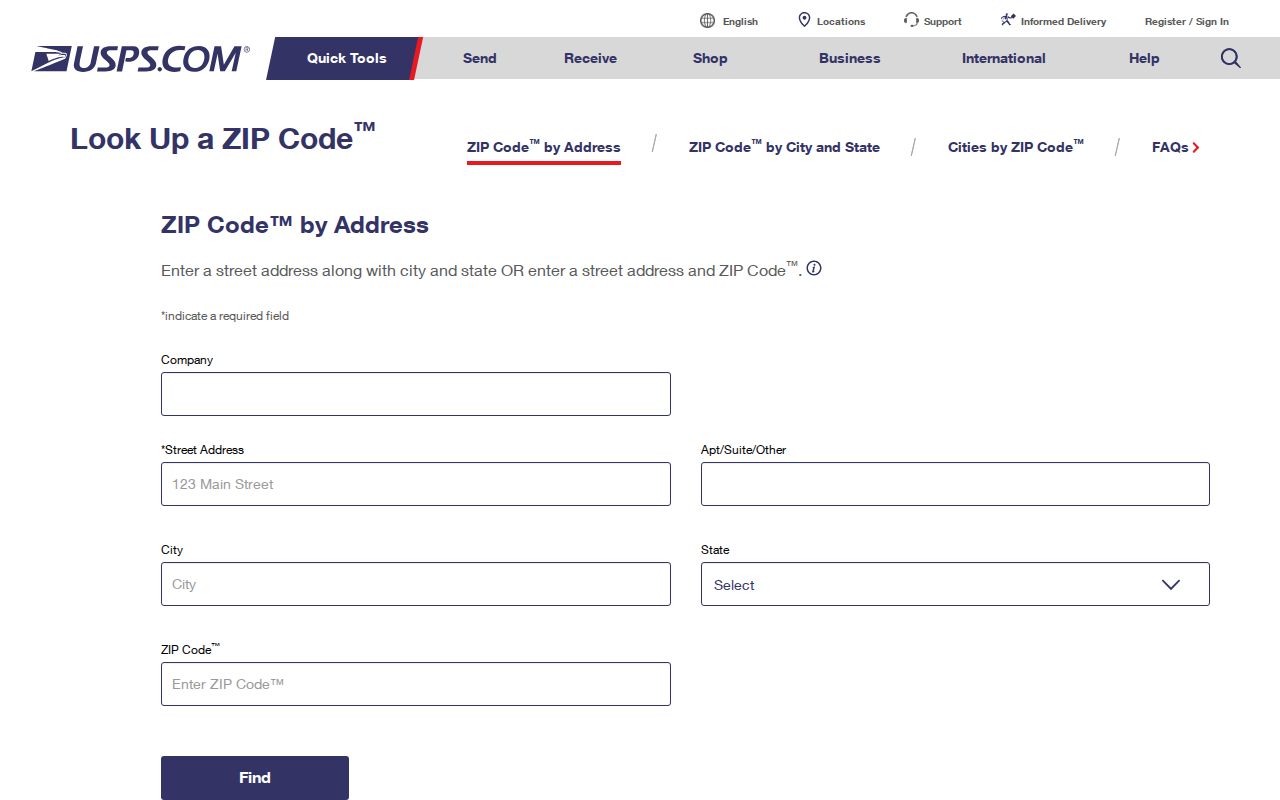
The USPS screen confirms delivery geography, while Smyrna and Cobb maps answer jurisdiction and parcel questions.
Smyrna's 2014 ZIP Shift
On July 1, 2014, designated deliveries in 30080 and 30082 changed to Atlanta 30339. That realignment creates a practical search trap. The same physical site can appear under a Smyrna postal label in an older directory or filing and under Atlanta in a newer record. A name and street search may miss one era if the postal city is treated as fixed.
Bridge the change with durable property keys. A parcel identification number, land district and land lot, subdivision, lot and block, or deed legal description can survive a postal relabeling. Planning and Zoning handles property addressing and platting, while the Cobb Clerk deed index ties recorded instruments to legal descriptions. Those fields are stronger than ZIP alone when the goal is to follow one site across the 2014 break.
Search both labels. For an east-edge record spanning 2014, test Smyrna and Atlanta, then match the parcel or legal description.
Find Smyrna Residents by ZIP
No verified Smyrna public portal produces a ZIP-wide owner or resident list. Cobb's lightweight property search expressly rejects ZIP input and asks only for house number and street, with no apartment, city, state, or postal code. Georgia's My Voter Page is an individual self-lookup using first initial, last name, Cobb County, and full birth date. It is not a public ZIP browse tool. A broader voter extract must follow the Secretary of State or Cobb Elections request channel and applicable public-record limits.
- Confirm the complete address and current postal result through USPS. Do not treat that result as proof of occupancy.
- Check Smyrna's address autocomplete map for city limits, ward, parcel context, zoning, and local services.
- Enter only house number and street in Cobb Property Search, then save the PIN, land district, and land lot.
- Use the resident's name in the proper official index, or request a lawful ZIP-based voter extract through the records custodian.
Once a postal area narrows the task to one road, the Smyrna street directory provides the full street-level workflow. That handoff matters because address and parcel systems, not ZIP filters, contain the local owner and deed trail.
Cobb Rejects ZIP Search
Cobb GIS asks for House Number and Street and tells users to omit apartment or unit, city, state, and ZIP. The result can supply a PIN, land district and lot, jurisdiction, tax class and district, precinct, polling site, school or service areas, and links to assessor and plat research. It is a geography bridge rather than an occupant directory.
The assessor can show the indexed owner, a mailing address, a situs address, values, parcel traits, and deed or sale references. Situs means the physical taxable location. Mailing address means the destination for owner correspondence. They may differ for ordinary reasons, and neither field lists all people in a household. The Smyrna ZIP code directory therefore narrows geography but does not replace the parcel check.
Smyrna ZIPs and County Islands
Smyrna began in 1872 with a one-mile-radius boundary around Smyrna Boys' Academy. Later annexations tied to parcels and development produced an irregular modern edge and unincorporated islands. A 2020 city study examined northern clusters of more than 290 acres, an eastern area near 2,400 acres, a southern area near 3,000 acres, and a western area under 600 acres. The study was analysis, not proof that every area became part of Smyrna.
This geography is why ZIP alone cannot choose the custodian. City status affects Smyrna zoning, permits, ward, garbage service, and municipal records. Unincorporated status can shift the relevant agency to Cobb County. Confirm each parcel instead of assigning jurisdiction to every address that shares 30080 or 30082.
Smyrna Postal Areas by Era
Older railroad-era and mid-century neighborhoods, including Williams Park, Forest Hills, Smyrna Heights, and Cheney Woods, often leave useful trails in directories and local newspapers. Newer Vinings-branded developments are more likely to produce later plats, deeds, permits, and community records. The postal wording around Vinings, Smyrna, and Atlanta at the east edge can vary across those sources.
Redevelopment can also reconfigure address evidence. Smyrna's civic chronology includes Village Green work beginning in 1988, a library and community-center dedication in 1991, and Market Village opening in 2002. No citywide Smyrna street-renumbering year was verified. When an address disappears, test its older postal city and street form, then bridge eras with parcel and legal-description data.
Smyrna ZIP and City Limits
A ZIP code is a mail-routing tool. It is not a municipal boundary, parcel map, voting district, or proof of residence. Smyrna postal labels can extend into a county area, while 30339 can use Atlanta as the postal city near Smyrna and Vinings. The mismatch changes how a search should proceed: USPS confirms mail delivery, Smyrna GIS tests city limits, Cobb GIS identifies parcel and service geography, and the assessor and clerk connect names to property records.
- ZIP vs ZIP+4
- A ZIP is the five-digit delivery area; ZIP+4 adds a smaller delivery segment for a specific address or group.
- PO-box ZIP
- A code or portion of a code used for post-office boxes rather than normal street delivery.
- Unique ZIP
- A code assigned to one high-volume organization instead of a broad neighborhood.
- Carrier route
- The set of delivery points served by one postal route, which does not match city or voting lines.
Use the right key for the question. Postal code finds the delivery area. PIN and legal description trace a parcel. A voter precinct describes election geography. None of these alone identifies every resident at an address.